LAKE BISTINEAU CONTINUED.
Page 2
1902- The first long-distance telephone line
was erected into the area connecting Minden with Monroe.
1906 - Bayou Dorcheat was
soon to have another railroad bridge crossing just north of present day I-20. The Minden
East & West Railway was chartered in March 1906 by F H Drake and associates to build a
railroad from Minden to Shreveport; however, construction stopped after only eight miles
of track had been built, including the bridge over Bayou Dorcheat. Whatever the reason for
stoppage; be it cost overruns or simply lack of funds, the incomplete tracks did not lay
dormant, but were used to bring timber to a mill in Minden. Then in March 1909, the
L&A purchased the ME&W and completed the line into Shreveport by the end of the
year.
1910 - The vast commercial and
community activities surrounding the Lake Bistineau and Bayou Dorcheat area were now
being supported by a significant Railroad system with Sibley,La. as a major hub. The
following schedule of the passenger trains serving Sibley in Sept 1910 depicts the
energy of activity in the area that had been spawned by the earlier water navigation
provided by Lake Bistineau and Bayou Dorcheat:
6:10AM--L&A train #3 from Shreveport to Alexandria
7:00AM--SLB&S train #1 from Yellow Pine to Sibley
7:15AM--VS&P train #12 from Shreveport to Birmingham
7:45AM--SLB&S train #2 from Sibley to Camp Long
10:03AM--VS&P train #9 from Monroe to Shreveport
11:59AM--L&A train #2 from Alexandria to Shreveport and Hope*
12:20PM--VS&P train #1 from Chattanooga to Shreveport
12:30PM--L&A train #1 from Hope and Shreveport to Alexandria*
3:55PM--VS&P train#2 from Shreveport to Chattanooga
5:53PM--L&A train #4 from Alexandria to Shreveport
7:08PM--VS&P train #10 from Shreveport to Monroe
9:51PM-- VS&P train #11 from Birmingham to Shreveport
* service to Shreveport was provided by a
connecting train from Minden,see 1906.
It was because of this extensive railroad system, the abundance of timber and the close
proximity to Bayou Dorcheat that International Paper Company officials had at one time
selected Sibley as home for a major Paper Mill. According to Danny Hillidge, of Sibley,
the local residents, aware of the strong sulfur odor that would be emitted,
protested and the Mill was built in Springhill, La. instead.
1915- The very first oil well was drilled in the Lake Bistineau area
near Elm Grove.


1920-
Sometime during the late teens or early 1920s, a combination gas station, restaurant,night
club,etc. called the Dixie Inn opened on the west bank of Dorcheat, by the bridge(see1857)
over Bayou Dorcheat. It is believed that the community we now know as "Dixie
Inn" was subsequently named for that business. The Sheppard family of Minden bought
and reopened the restaurant/club in about 1927 and operated it for a short time and
subsequently passed through several different hands and names before becoming the Lakeside
Inn during the 30s. During at least part of this time it was operated by the Jones family
of Minden that later operated the Southern Kitchen. It was a very popular dance spot and
restaurant during his time, and also was aided by the end of prohibition, making alcohol
legal.
The business thrived during the 40s as the war and the Shell Plant
were in full operation. However, as employment at the plant dropped off after the war and
the area was again voted dry in the late 40s, eventually the business went broke. The
business is now known as the Bayou Inn, owned and operated by Earl Uzzle, taking
over from the Walls in the early 90s.
The original bridge that spanned the Bayou and provided the setting
for the restaurant/club was later replaced by the "old 80" bridge that was
eventually closed and replaced by the current bridge located a few hundred yards south.
The "old 80" bridge was not removed however, and still stands as a landmark to
the original US Hwy 80 that spanned the US from east coast to west coast. US 80 was
replaced as a primary east-west corridor with Interstate 20 in the 60s.
1930- The Lake was given the designation as
"The Lake Bistineau State Game and Fish Preserve" by Legislation and the
Conservation Commission was created to govern the lake. (see 1969)
1933 - Killer tornado hits area. At four
o'clock in the afternoon of 1 may 1933 a hugh dark cloud came out of the northwest and
swooped down on the east side of Dorcheat Bayou, killing twenty-five and injuring over one
hundred in the Minden area. Buildings were shattered into debris as 150 homes were
destroyed and over 300 damaged before the storm was finished.
1935
- The Lake Commission began construction
of a dam to maintain the lake at a more useful level.(see1938)
1937- The 1915 oil well was the first
drilled in the vicinity of the lake near Elm Grove, But the first well drilled in closest
proximity to the lake was opened near its eastern bank by DeSota Oil and Gas Co. in
Bienville Parish in 1937.
1938- The dam forming the 13,500 acre lake
was completed, impounding Bayou Dorcheat and several small tributary streams and creating
a lake level of 137 feet, mean sea level(MSL).(see 1951)
1940- Fourteen bucktooth, rat-like nutria
were brought to South Louisiana from their native Argentina by E.A. McIlhenny of the
Tabasco sauce family in 1940. They got free and soon there population grew to the
millions, with Lake Bistineau becoming home for more than a fair share of the destructive
critters. " I have heard that they are eatable --- if you add a lot of
Tabasco sauce."

1941- As part of the pre-World War II
buildup, what is now named the Louisiana Army Ammunition Plant (Laap) was established on
the western boundary of Bayou Dorcheat, at the mouth of Lake Bistineau. Click here for
more info on LAAP.
1945- J C Merritt was a young boy and
fishing Bayou Dorcheat as a fairly regular routine...Now before I go any further with this
story I must tell you that 55 years later, fishing is still a fairly regular routine for J
C. Anyway, back to the story... It was around this time when J C and his Dad, Charlie were
fishing about where Old Cooley Creek emptied into Dorcheat and they found an old dugout
canoe that was mostly submerged in mud and water. It was so big and heavy that they could
not retrieve it so they brought some old wagon wheels down to the bayou and managed to
haul it to the bank where they cleaned it up.
The dugout was about 18 to 20 ft. long and appeared to be very old and carved by hand. It
had a hole in one end where J C believes a shaft of some kind was at one time used to
propel or guide the craft. J C and his Dad plugged the hole, added a motor and for a time
used the dugout as their fishing boat. J C recalls that "the motor would really push
it along pretty good, but when you got it moving along it was anything but easy to get it
stopped. J C's brother and cousin, after returning from WWII also used it when fishing for
a while, however the dugout met it's destiny later when vandals broke the lock used to
secure it and it was last seen years later, broken and sinking near the Doyline/Sibley
Bridge.
It is my belief that this old canoe was likely designed and built earlier by some
Coushatta or Choctaw Indians that used Dorcheat Bayou for their fishing and commerce.
Probably some of the same Indians that J C's Mom told him about seeing near their home in
the 20s and 30s. Their home was just north of Dixie Inn on the Bellevue road and the
Indians would pass near by in route to and from Bayou Dorcheat. It is also possible that
the canoe was used by residents of Overton Settlement before being abandoned or lost
before being found later by J C and his Dad.
 J C now lives with his lovely wife Dot
in Sibley, where if you pass by early enough you will probably see his truck and boat
heading to the lake. I just have to wonder sometimes... is J C really fishing all those
times out on the lake or is he out there hoping to hook that old canoe?
J C now lives with his lovely wife Dot
in Sibley, where if you pass by early enough you will probably see his truck and boat
heading to the lake. I just have to wonder sometimes... is J C really fishing all those
times out on the lake or is he out there hoping to hook that old canoe?
1950- The Chestnut Blight was found in New
York in 1904 and quickly spread accross the States. By 1950 the Blight was essentially
eliminating the chestnuts and chinquapin trees in the Lake Bistineau area.
1951 - The level of the lake was raised to
141 feet (referenced to the National Geodetic Vertical Datum). The top of the earthen
embankment is 153 feet ngvd and the spillway is 1200 feet long with twelve 6'x 6' gates,
with the bottom of the gates at 133 feet ngvd and the top of the spillway is 141 feet
ngvd. At full the lake has a surface area of 17,500 acres. At l34 feet the surface area
decreases to 7.500 acres and at 130 the surface would be reduced to little more than a
stream in the channel. Drainage area for the lake is 1,443 square miles.
1959-The state record bream was caught on
Lake Bistineau by Grant M. Kelly in Sept. It weighed 2 lb. 8 oz. and although it has been
tied once in 1961, it holds the number one slot in the state thru 1997. The Louisiana
Wildlife and Fisheries Commission provides current records of fish caught at Louisiana Fish
Records. Also, for tips on crappie fishing, you might want to click here on Crappie.
1964-In the heat of the night, back in 1964,
Mrs. Bellissimo developed a sauce that has created a national, make that international,
sensation. The Anchor Bar in Buffalo, New York is the undisputed home of the Buffalo
Chicken Wing. Frank & Teressa's Original Anchor Bar Buffalo Wing Sauce is the sauce
that has taken the humble chicken wing from local reviews to national acclaim. "
What has this got to do with Lake Bistineau?..."
Well, because
everyone on the lake enjoys the Wings, and when the question of how they got their name
"buffalo wings" was raised at a steak cooking outing hosted by Steve and Anita
Shows, some three decades later, almost everyone answered "I don't know"..
except Jimmy Dent who answered " they probably got started in Buffalo New
York". Jimmy owns Jimmy Dent Construction in Haughton and must be credited as a
"thinking man".
1965- The lake was almost impassable due to
moss and hyacinths.
1966- The three man Lake Commission, chaired
by C.B.McDonald of Minden, began a planned 5 year drawdown of Lake Bistineau by opening
the gates on Labor Day and lowering the lake level 5 ft..
1967- The gates were opened for the second
consecutive year at Labor Day and the lake level lowered 5 ft.
 1968- Bayou Dorcheat has its headwaters in
southern Arkansas and carries a large quantity of gravel from there to be deposited near
the head of Lake Bistineau. Portions of this gravel proved useful as raw materials by the
Caddo Indians and much of the remaining gravel has been has since been removed by
commercial operations. In 1968 Gifford-Hill began expanding their sand and gravel
mining operations from Bayou Dorcheat further south to the area on the northwest fringes
of Lake Bistineau known as the Old Salt Works area. Local residents complained that the
mining would destroy fish and game habitat however no action was taken by authorities
until 1978.
1968- Bayou Dorcheat has its headwaters in
southern Arkansas and carries a large quantity of gravel from there to be deposited near
the head of Lake Bistineau. Portions of this gravel proved useful as raw materials by the
Caddo Indians and much of the remaining gravel has been has since been removed by
commercial operations. In 1968 Gifford-Hill began expanding their sand and gravel
mining operations from Bayou Dorcheat further south to the area on the northwest fringes
of Lake Bistineau known as the Old Salt Works area. Local residents complained that the
mining would destroy fish and game habitat however no action was taken by authorities
until 1978.
The gates were opened for the third consecutive year on Labor Day and the lake
level lowered 5 ft.
1969- The Lake Commission was abolished and
all its powers and duties were transferred to the Louisiana Wildlife and Fisheries
Commission. The gates were opened for the fourth consecutive year on Labor Day and the
lake level lowered 5 ft.
It was also in 1969
that Bayou Dorcheat saw the last Passenger Trains pass over its waters. Just as the
railroads had replaced steamboats and wagons for passenger transportation in the
nineteenth century, so did automobiles, busses and airplanes replace passenger trains in
the twentieth century. The last passenger trains though Webster Parish on the old VS&P
line--owned by Illinois Central at the time--ran between Vicksburg and Shreveport on 30
March 1968.
The last passenger trains on the old L&A line ran on 3 November 1969,
when the Kansas City Southern's "Southern Belle" paused at Minden on its final
run between New Orleans and Kansas City. Another era in transportation through our area
had come to an end.
1970- On 1 Sept. a restraining order was
issued to the Louisiana Wildlife and Fisheries halting the lowering of the lake. The
scheduled drawdown was part of the 1966 plan to draw the lake down each year for five
years but camp owners;Archie Collins,Lee R Clark and Thradie Cryer, filed suit stating
that the prior four drawdowns had only harmed the lake and their business. The Judge
apparently ruled against the camp owners as the gates were again opened for the fifth
consecutive year at Labor Day and the lake level lowered 5 ft.
1971- For the sixth consecutive year
the gates were again opened on Labor Day and the lake level dropped 5 ft.
1973- The proposed Lake Bistineau Biological
Station to be located adjacent to the state park and operated by the Shreveport branch of
the Louisiana State University would be the only fresh water biology station in Lousiana
associated with a university acccording to Dr. Bobby F Dowden associate professor of
biology sciences. Dr Dowden said many groups and individuals had given their support to
establishment of the LSUS satellite, amoung them Governor Edwin Edwards and local and
state officials. Research possibilities include such subjects as fertilizer and
insecticide effect on the lake and its fish population, recreational development on the
lake's physical and chemical condition, numbers and distribution of fishes and their food
and the effects of water level fluctuation on plant and animal life.The first years
proposed budget of $55,900 was apparently never funded and the research facility never
materialized.
1975- Someone took a cutting torch to the
spillway gates causing thousands of dollars in damages in an effort to prevent the lake
from being lowered. However the drawdown went on as scheduled. The gates were opened at
Labor Day and the lake level dropped 7 ft.
1978- U.S. Army Corps of Engineers officials
issued a cease and desist order to Gifford-Hill stopping all mining of sand and gravel
from the Lake Bistineau area. Officials stated that the operations violated the Federal
Water Pollution Control Act implemented in 1976.
1978 also was the year that all gill netting
and commercial webbing was banned from the lake.
1979- "Bigfoot" like creature
reportedly stalking Lake Bistineau..."hey, check it out at the Koran sighting"
1980- The gates were once again opened at
Labor Day and the lake level was lowered 7 ft..
1982- The "Louisiana Invitational
Tournament" was held out of the State Park on Lake Bistineau drawing top fishermen
from 25 states. The three day tournament offered prizes of $75,000. A total of 543 fish
were caught weighing 1530 pounds with the largest at 6 pounds 15 oz.
1983- On the 2nd day of January, 48 year old
O.V.Stevens and his wife Betty, 38, their three dogs and two pigs staked claim to Peggy's
Island. They cleared about a half-acre of land on the island and pitched at least four
tents. They also built a couple of lean-to structures, a "kitchen area" with a
gas grill and a stove, and a living area with a dozen chairs in a semi-circle, A gas
generator provided the electricity for their campsite. The Stevens shared the island with
75 year old Isaiah Herron, who lived on a houseboat anchored just off a pier. Isaiah came
to the island from Red River where authorities ran him off. They intended to build a
cabin, "homestead" the island and eventually clear areas where families could
rent tents and camp on the island, before Louisiana Wildlife Officials sent them a letter
in June saying that they had 72 hours to vacate the State owned property. The Stevenses
said at the time that they were determined to stay on the island but the determination of
the Wildlife Department helped by one of the coldest winters on record led to the
demise of the "Squatters" on Peggy's Island.
1983-1984- Lake Bistineau experienced one of the
coldest winters on record and the lake froze over from bank to bank. Fortunate for the
lake, this came during a time when the lake was lowered7 ft., exposing acres of unwanted
moss and water hyacinths to the extreme conditions. This coupled with the spraying of
2,4-D wiped out most of the hyacinths that had all but shut down the lake just prior to
the drawdown. One Water Hyacinth can produce 65,000 plants during a normal growing
season. The hyacinths double themselves every 10 days and the flower produces a seed
viable for at least 10 years.
1986-
Government officials warn that erosion of a ditch in the Stumpy Lake Swamp of Loggy Bayou
threatens to destroy the dam and drain Lake Bistineau within 15 years. Funding of $500,000
to stop the problem was appropriated by 1987 state Legislature only to be axed in later
budget cuts. The Stumpy Lake Swamp is under the control of the La Wildlife and Fisheries
and the Lake Bistineau dam is under control of the La Dept of Transportation
Division(DOTD). A study by the Soil Conservation Service,now Natural Resources
Conservation Service(NRCS), in 1988 reported six alternative potential solutions to the
problem but because of funding problems no actions were taken until 1996 when DOTD
contacted NRCS for a geotechnical investigation for a structure located in the Potts Bayou
Ridge on the spillway outlet channel. But again funding delayed the investigation until
1998 when the results were delivered to DOTD for their actions. See 1998
for updates on this issue as they become available from DOTD.
1987- The Louisiana Dept. of Wildlife and
Fisheries granted to the La. Army Ammunition Plant a permit to withdraw water from Lake
Bistineau through an intake structure later constructed on Bayou Dorcheat just north of
the Doyline/Sibley Road Bridge. This permit included the development of a conservation
zone extending 100 feet from the bank of Bayou Dorcheat along the entire boundary of Laap
and the bayou requiring the land be left in a natural state with no harvesting of trees.
1991- At 147.5 feet (flood of '91) the lake
surface area was 26,500 acres (9000 acres under flood) Click here
for Flood Record
1991 also
brought to Fairview Point the one Stephen J Shows where he and his lovely wife Anita
reside and host the annual Memorial Day Celebration each May. Visitors to the Point are
often overheard discussing the legend of Peggy's Island and the capture of Spanish outlaws
on Fairview Point(see 1830) . Click here on Memorial Day for
information about this important celebration.
1993- New channel markers were installed on
the main channel by LWLF at an estimated cost of $50,000.
1993 was also the year that the LDEQ sampled
Lake Bistineau for possible mercury contamination. Bistineau was one of twelve lakes
in NW Louisiana selected for testing by the LDEQ. Although five of the twelve were found
to have levels of mercury concentration above acceptable limits, Lake Bistineaus levels
(0.49 ppm) were within acceptable limits and no health warnings were necessary.
1994- Lake Bistineau was given a five star
rating for the best place to water ski in the entire State by Louisiana Life
Magazine.
This is also the year that your's truly retired after 33 years at the Louisiana
Army Ammunition Plant and started assembling the information that you see here on this
page.
1995- Hydrilla was first noted in the summer
when one small plant cluster was found.
This is the year that yours truly(yes, me, I, myself, Joe D.) developed one of the
most surest ways for a man to get in trouble with his wife...Step 1- Take her fishing and
Step 2- Let her catch a 2 and 3/4 pound crappie and Step 3- Take a picture of her with the
fish and Step 4- When she goes to put the camera away........fillet the fish. If you
have any doubt about the severity of an act such as this, just try it sometime..but don't
say that I didn't warn you.
1996- Hydrilla plant colonies and matted
fringes were discovered throughout the lower 7 miles of the lake and a drawdown began on
Labor Day, however due to excessive rains the lake level failed to drop significantly. The
last drawdown was in 1983.
Also DOTD officials prepare to take bids on a new
Bistineau dam and bridge structure. The estimated $4 million contract was scheduled to be
awarded in November 1996 however DOTD had to later change the location of the new bridge
to ease construction and this delayed plan production(see1998). More information on road
construction projects in the area can be found at DOTD.
1997- Even though the lake level did not
fall to levels expected by the lake officials, the strong currents created by the flooding
rains that came during the "96 drawdown period appear to have flushed a significant
amount of the unwanted Hydrilla out of the lake. As a result, another drawdown attempt in
1997 will not be necessary. Even before the gates were closed in early Feb, 1997, the
water level was pouring over the top of the spillway and continued to rise to 146.5 foot
MSL or 6.5 feet over the spillway before the rains finally subsided in late april. This
was only 1 foot below the flood of '91, when 9000 acres of normally dry land and dwellings
were inundated by floodwaters. One must wonder what would have happened if the gates had
not been open during the onset of the '96-'97 rains.Click here for
Flood Record
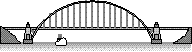 1998- DOTD reports that plan preparation for
the new bridge construction was in the final stages and bids should be received by the end
of the year. The new bridge is to be located 120' north of the exiting bridge and
will span the entire lake (approx. 7800'). DOTD states that concrete piers will be used in
construction and lowering of the lake will not be necessary. Estimated project costs have
increased to $12 million.
1998- DOTD reports that plan preparation for
the new bridge construction was in the final stages and bids should be received by the end
of the year. The new bridge is to be located 120' north of the exiting bridge and
will span the entire lake (approx. 7800'). DOTD states that concrete piers will be used in
construction and lowering of the lake will not be necessary. Estimated project costs have
increased to $12 million.
The "1998 Heat Wave" brought the hottest
month ever recorded in weather history at Lake Bistineau in July with triple digit
temperatures reaching 107. Daily high temperatures for the month averaged 100.7 degrees.
October '98- The latest information I have on the
"erosion" problem that threatens to destroy the dam and drain the lake is from
the State Wildlife and Fisheries office out of Baton Rouge which states that "the
erosion has slowed down alot because it has reached the live timber, but is still moving
toward the dam and will have to be dealt with sooner or later. Funding is a problem."
I have sent an inquiry to the Shreveport District Administrator for DOTD but got no
reply.(see 1986 for more details on the erosion issue)
1999- January ended with a deluge of rain
that not only recorded the month as one of the wettest Januarys in this area but raised
Lake Bistineau's level to 145.5 feet MSL, cresting on 2 Feb. Click
here for Flood Record
As of March '99, word from Baton Rouge DOTD about the new bridge construction at the
spillway is: Plans are being wrapped up for final distribution within the Department for
one last review in hope of taking bids this summer. More info on the bridge can be found
in '96 and '98.
The heavy rains of late '98 and early '99 also washed down the Swepco
poles that spanned the spillway on the Loggy Bayou side, leaving the high voltage lines
swaying in the water. Swepco, faced with this problem before, apparently decided to fix it
right and replaced the conventional poles with concrete structures on each side of the
water, spanning the high voltage wires high above the waters. This appears to be a
permanent fix to a prior recurring problem.
The Aquatic Plant Research and Control Section of the Louisiana Dept. of
Wildlife and Fisheries surveyed aquatic weeds on Lake Bistineau this summer. No salvinia
was found during those surveys. However, with the recent introduction of Giant Salvinia to
Toledo Bend and the close proximity of Lake Bistineau, Mr. Malcolm L. Leatherman, Aquatic
Plant Biologist for District III office-LDWF, Alexandria believes it to be only a matter
of time before we discover it here. He further reports that with the right growing
conditions, salvinia can become a major problem in many of Louisiana waterways. The LDWF
is currently not funded to treat salvania as it requires specialized herbicides that cost
in excess of $100.00 per gallon. Mr. Leatherman requests that anyone hearing reports of or
spotting salvinia on Lake Bistineau contact the LDWF, so that its presence can be
confirmed and documented. For description of salvinia click here Giant Salvinia
Thanks to information provided August '99,by Mr. Stephen J Shows of
Fairview Point,the Bistineau Bridge Repair has been rescheduled once more. This
information in the form of Senator Foster Campbell's, "Summer "99 Legislative
Report" states that the long awaited project to stabilize the Lake Bistineau Dam and
replace the Louisiana 154 bridge over the dam is scheduled for bid-letting in January
2000. According to the report, Campbell said "It is scheduled for construction next
spring, and I am urging the state Dept of Transportation and Development to uphold that
schedule. DOTD says the new bridge will cost an estimated $13.5Million with federal
funds paying the bulk of the costs. State funding sponsored by Campbell will provide the
estimated $1 million cost for dam stabilization involving dirt work and removal of
vegetation to control erosion.
It is November '99 and very dry!!! so dry, that the lake
level has been well below the spillway top for several weeks. The only water escaping into
Loggy Bayou comes from a leak in Gate #2, (numbered east to west)where the water is
venting through a 2.5" gap under the gate. This problem was created earlier when a
boat was swept into the gate causing damage that prevents the gate from fully closing.
Because Loggy Bayou is so low(one can walk across it immediately below the spillway)the
"leak" can be seen spewing water, otherwise one would not know that there was a
problem.
1999 was also the year that the Webster Parish Police Jury attempted to
"give" the Dorcheat Public Ramp to Dixie Inn. There is apparently more to come
on this issue... because of public outcry, the Jury had to take it back..temporarly or
permanent? that's the question..
2000- The Louisiana Dept. of Transportation
and Development's Project Engineer for The Lake Bistineau Bridge Project reports that
significant geotechnical(soil) analysis in the lake revealed a great number of problems
building the new dam in Lake Bistineau. Because of these problems extensive changes were
required of the plans and required right of way. These new plans were reportedly completed
in August '99 and the DOTD's Real Estate Section is doing new appraisals and purchases...
The bid-letting date of January 2000 earlier reported by Senator Foster Campbell has now
been delayed to January 2001. According to DOTD, "this delay is unfortunate but does
not appear avoidable".(See 1996 for
original bid-date)
acknowledgements:
The late Beth Drew Weaver for inspiring me to dig into the lake's history.
Mike Adkins, owner of LakeBistineau.com for teaching me how to publish on the
web
Helen Pate of Ringgold, La, my mother-in-law, for loaning me her Bienville Parish
History Book.
Susan McCain,Baton Rouge DOTD Project Coordinator for the Lake Bistineau Bridge
Project
Patsy Roach of Doyline, La for providing extensive documentation on Cultural
Resources of this area.
Dorothy Y. Bryant for "The History of Lake Bistineau1971".
Robert A. Hanneman,Dept of Sociology, University of California, Riverside for his
help on salt works at Bistineau
E.J. Giering III,
PE-PLS, Assistant State Conservationist,Engineering Services, NRCS for his help on the
"erosion problem".
Vicky Pullig of Doyline, La for her copy of a 1939 article on Lake Bistineau.
James Daniel for information about the Hay Meadow Dispute of 1896.
Stephen J Shows of Fairview Point, for info about the "Bridge
Construction" as well as many constructive reviews of the History page.
John Agan, Historian from Minden, La. for information about Dixie Inn..(the
business and the town,1920) Also, the historical significance of the Dorcheat Railroad
Bridge to Webster Parish in 1884.
Malcolm L. Leatherman, Aquatic Plant Biologist, District III office-LDWF,
Alexandria, for infomation on Giant Salvinia.
Joseph C Merritt of Sibley, La. for finding the Indian dugout in 1945.
Michael M. Palmieri of New Orleans ( http://lrs.railspot.com
) for information about the Dorcheat Railroad bridges built in 1884 and 1907, details on
the SLB&S Railroad in 1899 and other interesting info included in 1885,1898,1906 &
1969.
Danny Hillidge and Earl Smith Jr of Sibley, La. for additional information about
the Sibley Railroad in1899 and the Dorcheat swing span bridge in 1884.
Drew White for information about the Overton Settlement.
Webb Stewart for providing copies of his collection of documents and articles about
local history.
Clifton D. Cardin, Bossier Parish Historian, for his study of Allentown(1891).
If I have
left anyone out or have infringed on anyones copyrights, please let me know and I will
correct it immediately. This is strictly a non-profit, for fun only exercise. Thanks, to
everyone. Joe D Hinton
return to page 1